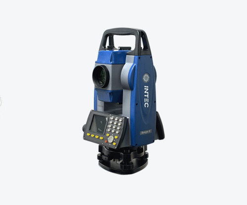
GNSS refers to the entire network of satellite navigation systems operating globally. This includes the United States’ GPS, Russia’s GLONASS, Europe’s Galileo, and China’s BeiDou. Each system has its own satellites, frequencies, and operational methods, but together they form a powerful, global infrastructure for positioning and navigation.
While GPS is a single constellation under the GNSS umbrella, GNSS-enabled receivers can access multiple constellations simultaneously. This means faster fixes, greater accuracy, and improved performance in challenging environments — something that traditional GPS-only devices cannot always achieve.
The Role of GNSS in Intec Products
Intec integrates GNSS and GPS technologies into its products to ensure they deliver precise, dependable, and consistent positioning data. Whether used in asset tracking devices, fleet management systems, or environmental monitoring solutions, GNSS offers:
- Centimeter-Level Accuracy (when combined with techniques such as RTK — Real-Time Kinematic positioning).
- Resilience in Urban Environments, where tall buildings and narrow streets can obstruct satellite signals.
- Global Coverage, allowing seamless operation regardless of the user’s location.
For example, Intec’s leverages multi-constellation GNSS receivers to maintain accurate tracking even in dense forests or construction sites with limited sky visibility.
Why GNSS Integration Matters for Customers
End-users may not always think about the technology under the hood, but they do notice the results:
- Delivery drivers reach customers faster with optimized routes.
- Farmers reduce fuel consumption and waste by guiding machinery with pinpoint precision.
- Utility companies locate underground assets quickly, avoiding costly mistakes.
By adopting GNSS-based solutions, businesses benefit from improved efficiency, reduced operational costs, and enhanced safety.
Technical Advantages Intec Brings to GNSS Implementation
While GNSS is a global standard, the way it’s implemented can make all the difference. Intec enhances standard GNSS capabilities with:
- Multi-Constellation Support: Accessing GPS, GLONASS, Galileo, and BeiDou for maximum reliability.
- Advanced Filtering Algorithms: Minimizing errors caused by multipath signals or temporary obstructions.
- Seamless Integration with IoT: Providing not just location data, but actionable insights through connected platforms.
These refinements mean Intec products don’t just report where something is — they make that information meaningful and usable.
Looking Ahead: The Future of GNSS in Intec Products
The GNSS landscape is evolving rapidly, with improvements in satellite coverage, accuracy, and data transmission speeds. Innovations like dual-frequency receivers, PPP (Precise Point Positioning), and integration with 5G networks are on the horizon. Intec is actively exploring these advancements to ensure that future products remain at the cutting edge of positioning technology.
For customers, this means even more reliable service, better performance in challenging conditions, and integration with other next-generation technologies.
Conclusion
GNSS and GPS have transformed the way the world moves, measures, and manages resources — and for Intec, they are core enablers of product excellence. By embracing multi-constellation GNSS, enhancing it with proprietary algorithms, and continuously investing in innovation, Intec ensures its customers can depend on accurate, real-time location data, no matter the application.
In a marketplace where precision equals profit, Intec products put accuracy first — powered by GNSS and GPS.


